John Manning
Geospatial Technology. Most of us don’t even know what it is, but it is quickly becoming one of the fastest growing technologies used by a variety of industries.
Edgecombe Community College offers a degree and certificate program in geospatial technology, and one recent graduate has found great success in this emerging field.
John Manning, 30, who completed an associate of applied science degree in Geospatial Technology at ECC, has gone on to a successful career, thanks to his niche knowledge of this cutting edge technology.
Manning describes geospatial technology as a way to map information spatially, using a Geographic Information System (GIS). A GIS consists of a database of features used to model different aspects of a location.
These features can form different thematic layers, overlayed on one another. Attributes of the features are stored in the database along with a spatial representation. Different types of analysis can be done ranging from modeling suitability, interaction, patterns, relationships, measurements, and statistics.
“Think of geospatial technology as modeling the earth on a computer. This information can be created by using GPS equipment or old maps,” Manning says. “I’ve always been interested in maps and aerial point of views of earth.”
When he began looking for a degree program to advance his goal of becoming a surveyor, he was pleasantly surprised to learn he didn’t have to turn to a larger, metropolitan college. As he started researching the best programs in the state, it became clear to him that Edgecombe Community College with its Geospatial Technology program was the best place for Manning to enroll.
He was excited to find an option more specialized than the general surveying curricula. “Originally I was interested in Wake Technical Community College for surveying. After researching online programs, I found out about the Geospatial Technology program at ECC.”
This program of study is offered in a 100% online environment. Students can complete the degree and certificate options from a distance without ever coming to the ECC campus.
Manning began the program in Fall 2013 and graduated in Spring 2015. He says the convenience of location (he was living in Rocky Mount) and the value and low cost of the program were factors in his decision to enroll at ECC. He says he received the best quality program and has a great appreciation for his teachers.
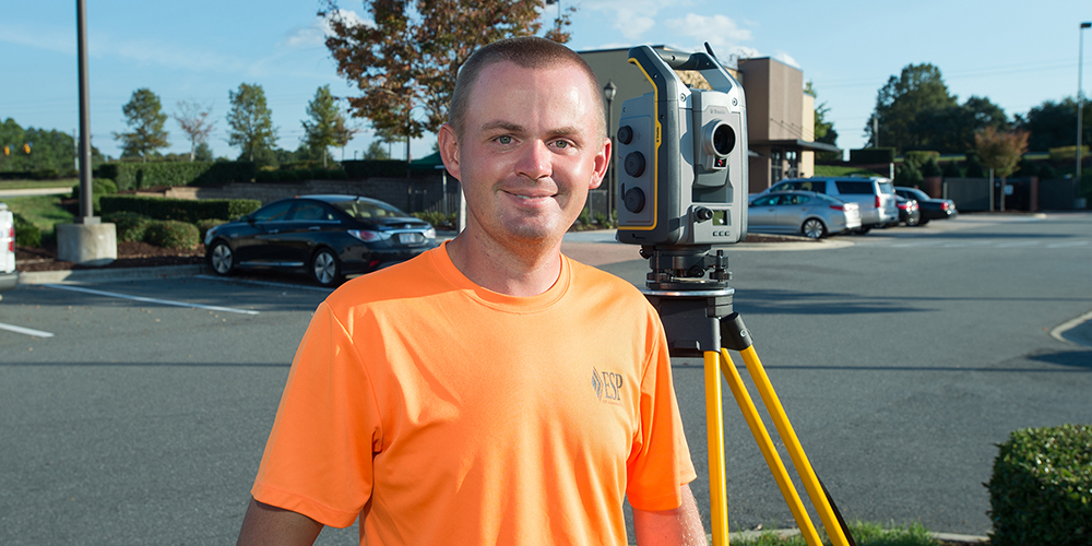
After receiving his Geospatial Technology degree from ECC, Manning worked with Joyner Keeny, PLLC, in Rocky Mount, a surveying company. “Initially, I was a surveyor’s assistant, but was promoted to party chief shortly thereafter,” Manning says.
“I have since moved on to work for ESP Associates in Raleigh, a national engineering, land planning, and surveying company. Currently I am in the role of a survey party chief and am working to become a CAD (Computer Aided Design) technician.”
Because he now lives in Raleigh, Manning is taking classes this fall at Wake Technical Community College to obtain CAD certification.